Algonquin Park High Point
Country: Canada Region: Ontario Elevation: 578 m Prominence: 367 m Location: 45.6489, -78.2569
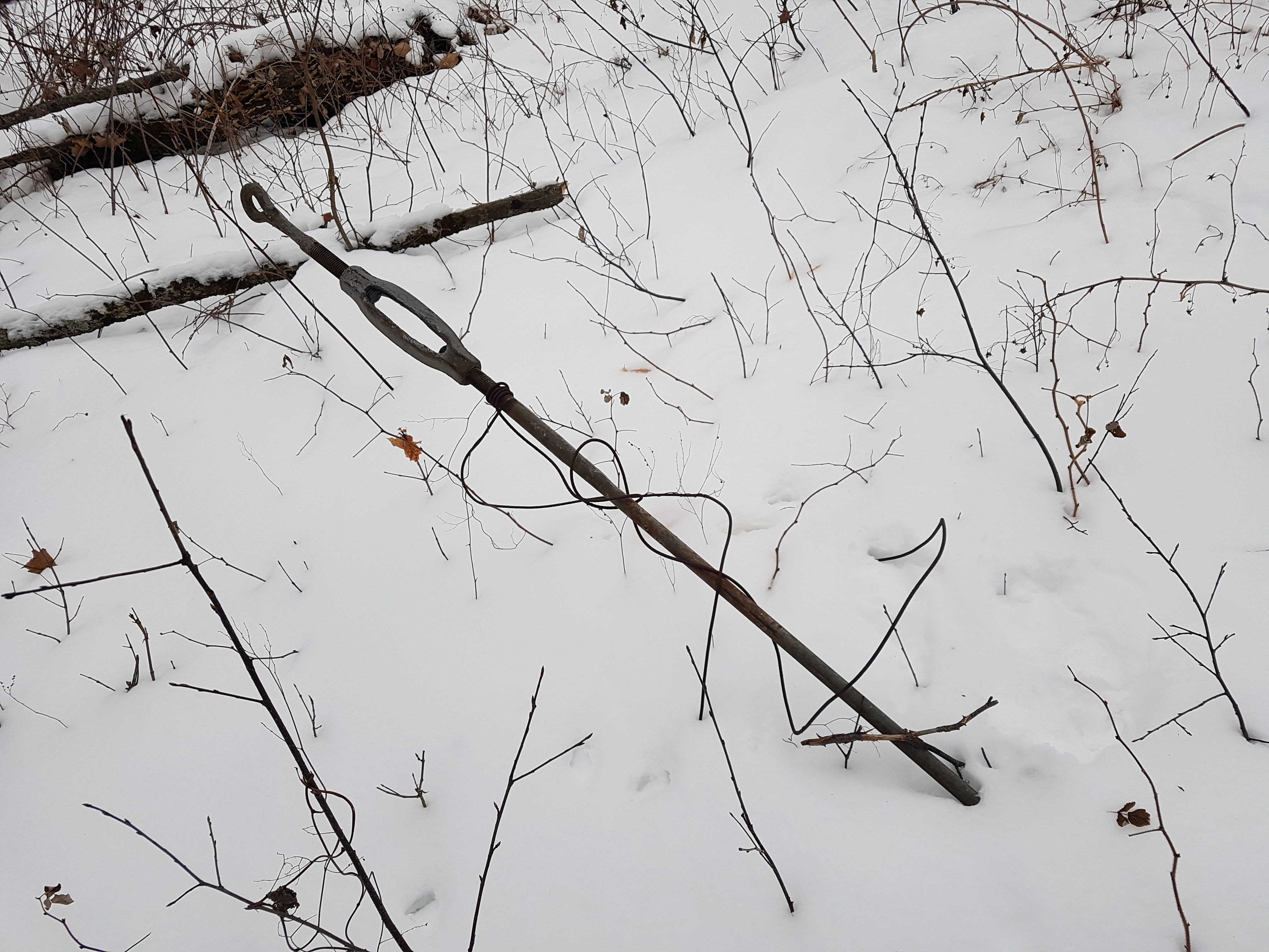
Algonquin Park is Ontario’s most popular provincial park for camping. Known for its many lakes, rolling hills, and endless boundaries. The highest point in Algonquin Park is a pinnacle point, despite it looking like an ordinary forested hilltop. At 578 m of elevation, this point is higher than anywhere in Ontario south of Algonquin. A fire tower once stood at this site. Its remains can be used to confirm you are at the pinnacle point.

Routes to the Pinnacle Point
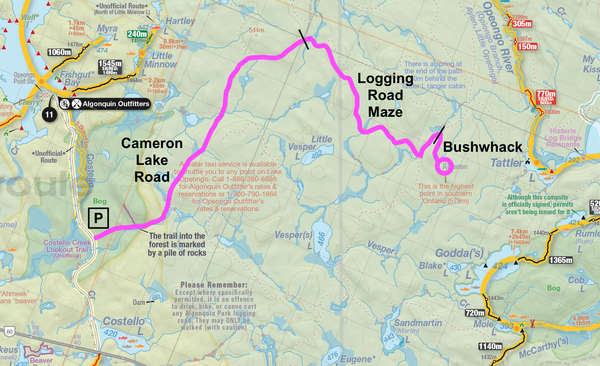
Unfortunately, there is no official trail to Algonquin's pinnacle point. There is a string of logging roads that can be used to get most of the way, however, it is illegal to drive on logging roads in Algonquin, they can only be travelled on by foot. There is a small parking lot at the intersection of Opeongo Road (off Highway 60) and Cameron Lake Road. The hike from this parking lot to the pinnacle point is 12.2 km one-way, the first half of which follows Cameron Lake Road. It is very easy to get lost by going down a wrong fork in the road. There are many more than what is shown on the map, it is a bit of a maze. I would recommend bringing a map, compass, GPS, and a friend. No matter how you get there, at least a little bushwhacking will be required to ascend the final hill.

Winter Hike - Multiple Days
The land route is a 24.4 km out-and-back trail. It is a little far to do as a day hike for most. Breaking the hike up over two days is more managable. Thankfully, in winter, Algonquin allows you to camp just about anywhere in the park, so long as you set up camp at least 30 m away from a lake, trail, portage, or summer campsite. This means if you are willing to go winter backpacking, you can break up the hike however you see fit over multiple days. In winter, Opeongo Road is plowed up to the Cameron Lake Road parking lot, so that is no issue. Since there are no summer campsites along the land route, it can only be hiked over multiple days in winter.
Summer Hike - Single Day
If you are an experienced hiker, the 24.4 km land route is doable in a single day. Most of the route follows logging roads afterall, making for easy hiking. Just be sure to start early in the day to give yourself time for the return.
Portage
The pinnacle point looks to be an easy bushwhack from the west side of Tattler Lake. I am much more of a backpacker than a portager personally, so I can't suggest routes to get to Tattler Lake by canoe. At first glance, it doesn't look like a particularily easy lake to reach, though it can certainly be done with a number of portages.
My Journey
Route: Winter Hike - Multiple Days Dates: Dec 2-3, 2023 Most Notable Bird Sighting: Red Crossbill
| Day # | Distance (km) | Elevation Gain (m) |
|---|---|---|
| 1 | 12.2 | 430 |
| 2 | 12.2 | 120 | Total | 24.4 | 550 |
Writing an algorithm to find the world's pinnacle points was a truly delightful undertaking. I got the first result I was happy with near the tail end of 2023. The closest pinnacle point to me, in Ottawa, was the highest point of Algonquin. It was early December, far from premium backpacking season. However, this was not my first time backpacking in winter. I was eager to reach of one of these points I had been trying to unviel for months. I would attempt to backpack to Algonquin's pinnacle point over two days, solo, planning on camping right on the summit in my hammock.
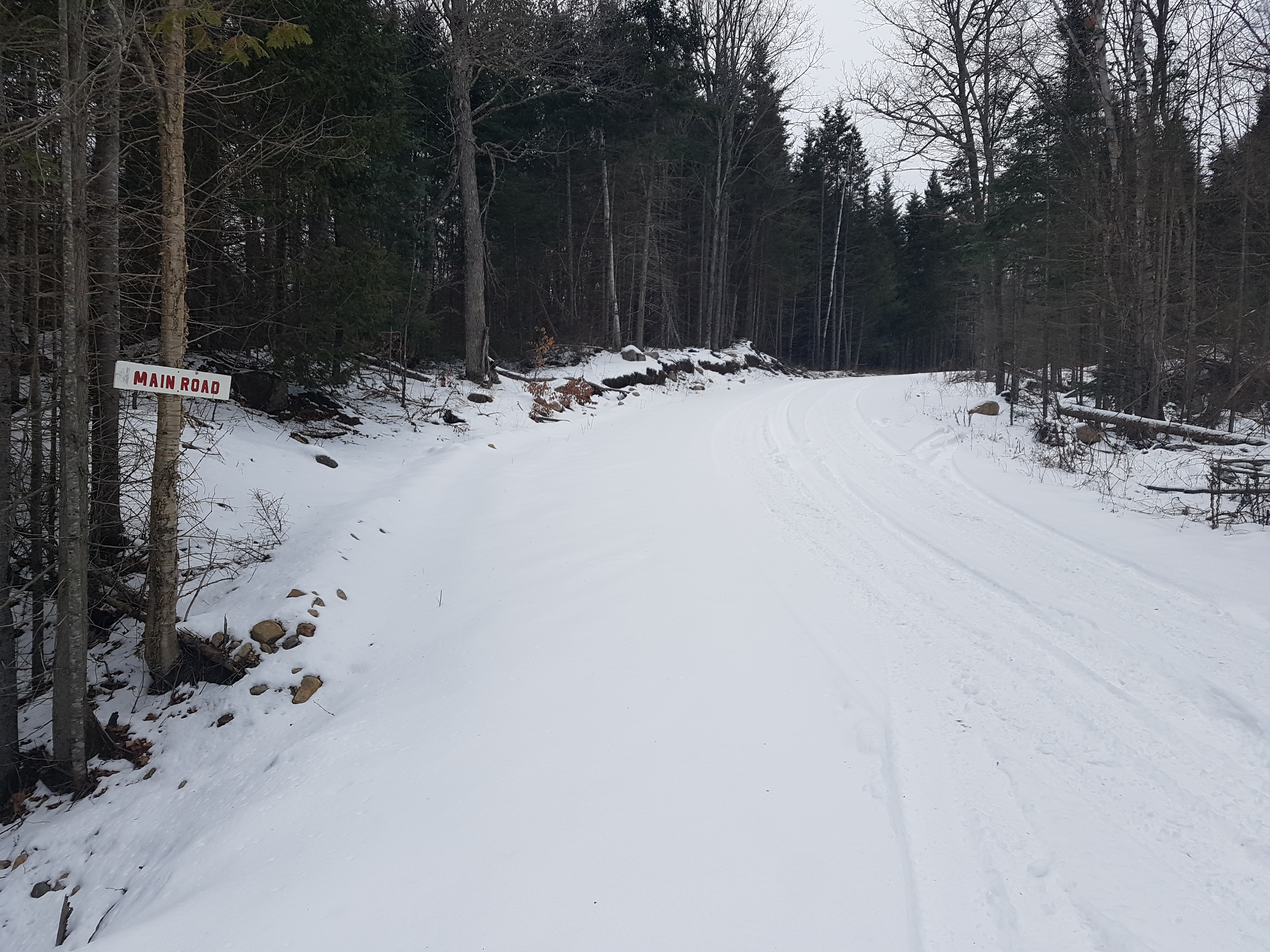
As I drove north to Algonquin Park, the snow on the side of the road slowly got deeper, from a light dusting to several inches. When I arrived at the parking lot, I was the only car there. Despite the snow, it wasn't too cold. It was partly sunny and just below freezing. As I started hiking down Cameron Lake Road, I found myself to be particularly lucky. A truck had recently driven down the logging roads exactly along the route I needed to go, leaving behind a path of packed snow for easy hiking. Whenever I arrived at a fork and I wasn't sure which way was right, I favoured the truck tracks. They never failed me. The terrain was obviously smooth on the logging roads, but they were moderately hilly. There were no lookouts, lakes, or rivers on the way. Only rolling forested hills.

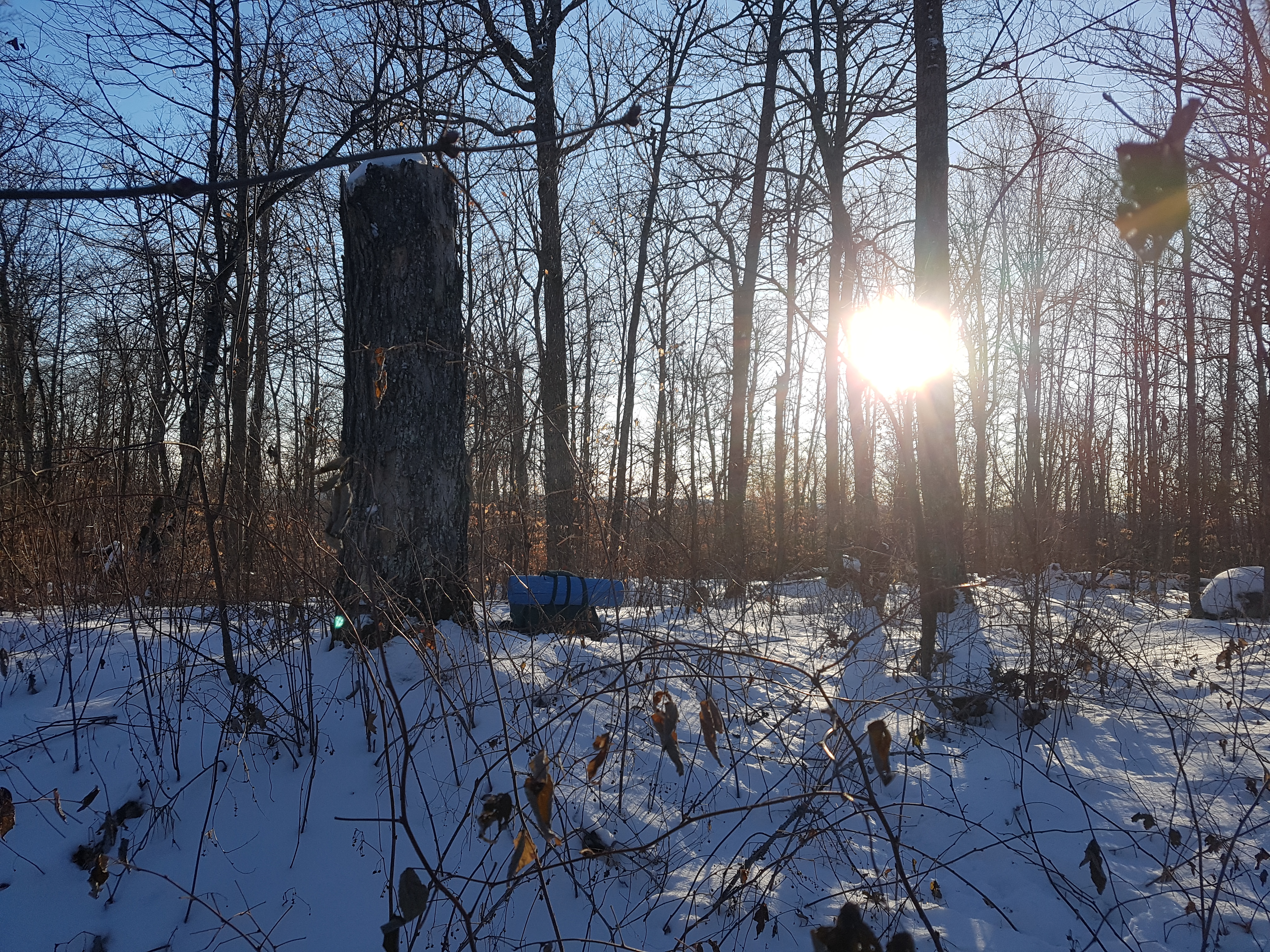
I eventually made it as close to the pinnacle point as I could by following logging roads. I would be bushwhacking from here. I jumped over the roadside ditch and started hiking upward, quickly leading me to a nearby false summit. After a corresponding false celebration and recalibration, I hiked to the real summit of Algonquin Park, my first pinnacle point. I found a few metal artifacts that must have been part of the old fire tower. Most of the view was obstructed by trees, though there being no leaves gave me the best view one can get. I had an hour before sunset to set up camp and cook dinner. My hammock was directly over the fire tower remnants, though I wouldn’t recommend this. A campfire kept me warm while it lasted, but it turns out that pinnacle points can be windy and December is cold. Two sleeping mats, two sleeping bags, and a liner was not quite enough to stay warm throughout the night, even with all my puffy clothes. I should have camped in a lower more protected area. I hiked back to the car early the next morning, following the footprints that got me there.

Conclusion
I can’t necessarily say I would recommend visiting this pinnacle point, other than for the novelty of adding a pinnacle point to your list. Even though the hike is among rolling forested hills, it is mostly road walking without a good lookout to make up for it. In summer there would be would be no view what so ever. All this being said, I have no regrets. I was eager to be the first person to knowingly summit a pinnacle point. It isn’t too difficult to get to if you have a GPS. The only difficult section is the bushwhack, which is brief. I’m glad I carried in all the water I needed, I never passed a good water source. If you do camp, do so in winter, follow park regulations, and consider setting up camp somewhere more protected than the pinnacle point itself. It is entirely possible for a day hike in summer or a portage trip to Tattler Lake to give easier access.
